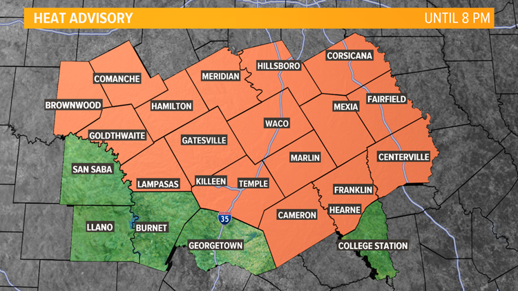
TEMPLE, Texas — A heat advisory continues for most of Central Texas through 8 p.m.


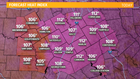
Be careful out there! Stay hydrated and avoid strenuous outdoor activities. A lot of us will have a heat index of 105 degrees to 111 degrees this afternoon. Always remember to check the backseat.
►KCEN Channel 6 News | Download the app
Forecast Heat Index Values:

A slow-moving “cold” front will move in late afternoon into tonight. This front will help spark up showers and thunderstorms mainly late afternoon into this evening. Highest rain coverage will be for counties along and west of I-35.
Today’s Severe Weather Outlook:
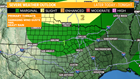
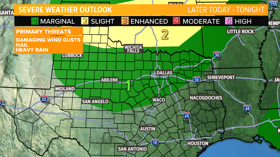
Some of Central Texas under a level 1 “Marginal Risk”. This means isolated severe thunderstorms are possible.
Here’s a breakdown of each level:
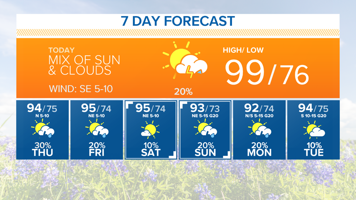
TODAY: Mix of sun and clouds. Afternoon isolated (20%) showers and thunderstorms are possible mainly after 4pm. Wind: SE 5-10 mph. High: 99°.
TONIGHT: Mostly to partly cloudy. Scattered (30%) showers and thunderstorms possible. Stronger thunderstorms may produce high wind gusts, frequent lightning, and heavy rain. Wind: S/N 5-10 mph. Low: 76°.
10 AM TROPICS UPDATE:
As of 10 a.m., we are watching an area of low pressure over the Gulf of Mexico that is producing showers and thunderstorms.
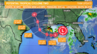

Potential Tropical Cyclone Two will likely organize into a tropical depression later Wednesday or Thursday.
A Tropical Storm Watch is in effect for the Louisiana Gulf Coast
This system may strengthen into a category 1 hurricane as it approaches the Central Gulf Coast by this weekend.
Regardless of development, heavy rain is expected along the Gulf Coast from Florida to Texas, mainly east of Houston. Parts of Louisiana may see 6 inches to 10 inches of rain with isolated higher amounts over the next seven days.
Forecast Rainfall:
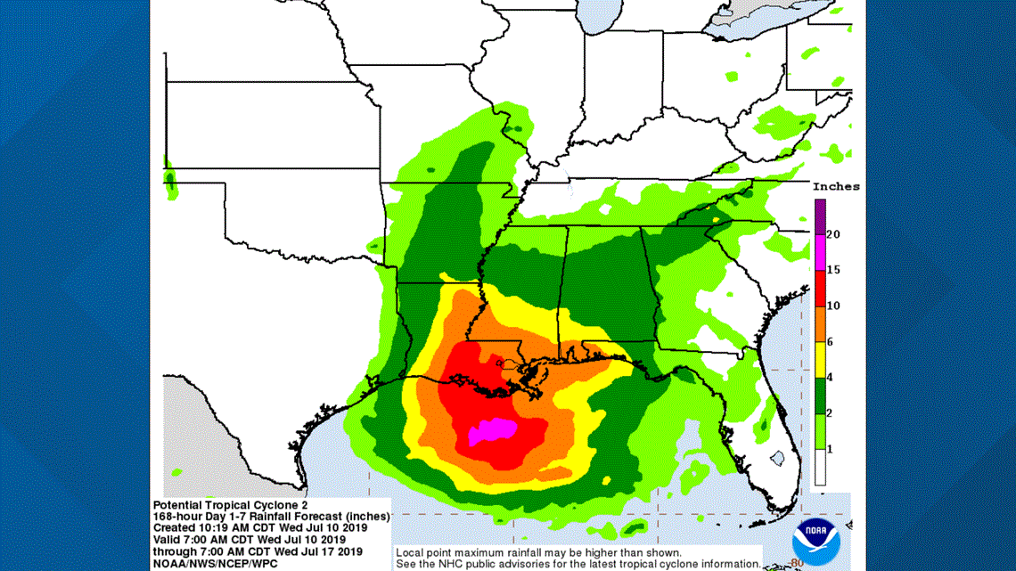
Intense wind gusts, flooding, and storm surge are also possible. A storm surge watch has also been issued for southeast Louisiana and more tropical alerts will be issued Wednesday.
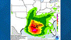
Most models are in agreement with this system moving west over the Gulf of Mexico toward Louisiana and East Texas. It’s always best to be prepared and have a plan in place.
10 a.m. Forecast Track:
If this track shifts west, Central Texas could see higher rain chances Sunday into early next week. Stay tuned for updates.
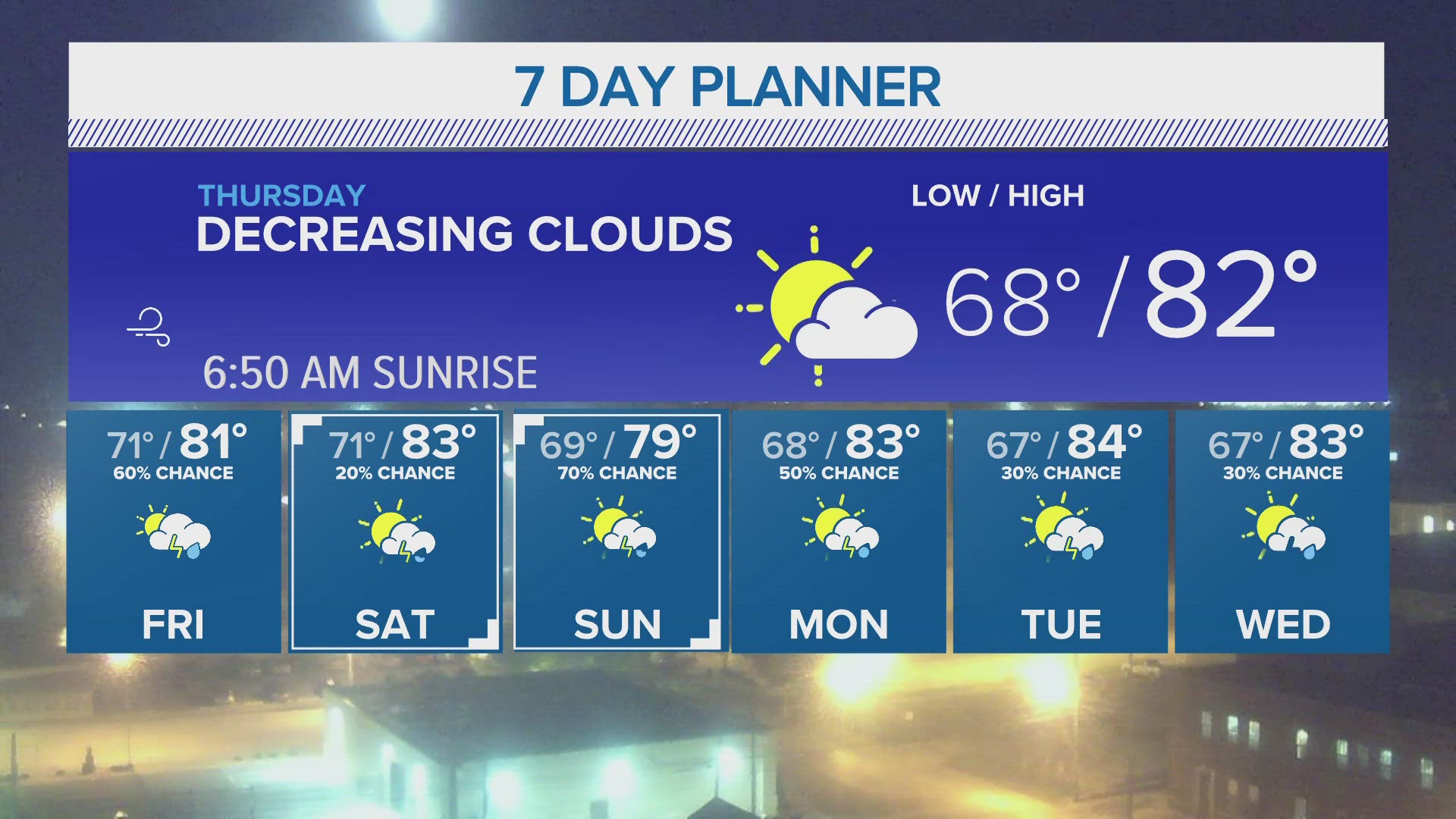
THURSDAY: Mix of sun and clouds. Afternoon scattered (30%) showers and thunderstorms. Wind: N 5-10 mph. High: 94°.
Extended Forecast:
Be sure to like KCEN 6 on Facebook so when severe weather starts, you'll get the latest updates as our meteorologist go live and break down what's heading your way.
Follow our weather team on Twitter and Facebook for breaking weather updates as well: