
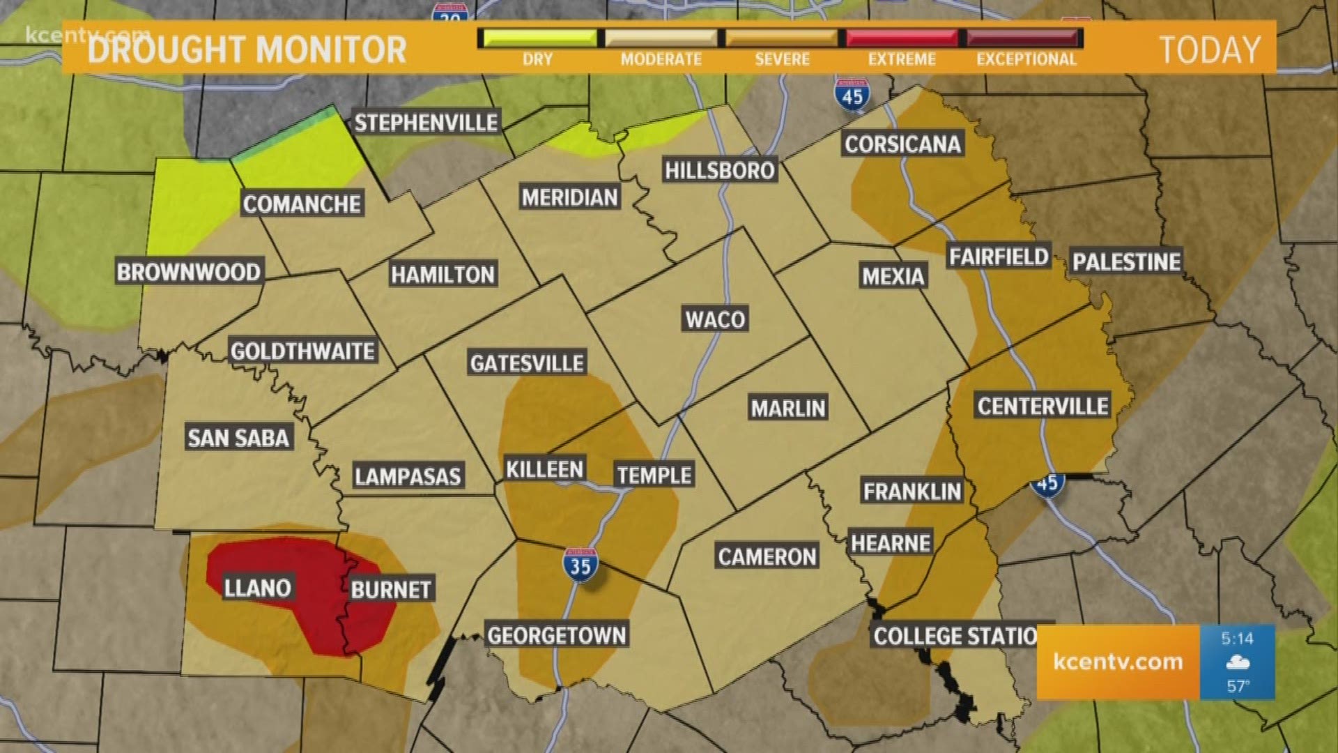
TEMPLE, Texas — The invasion of a more moisture-rich air mass has led to low rain chances and patchy dense fog to start the workweek. Moderate to severe drought conditions took hold of Central Texas during the back half of 2019 and have carried over into 2020, so its great news that rain chances are sticking around.
Scattered showers will continue through Friday night and exit to the east early Saturday morning.
You may notice the return of muggier conditions like we experienced before last Friday's severe weather event. While warmer, moisture-rich air has returned, no big storm systems will be tracking over us like last week.
►6 News | Download the app
Disturbances will stay further north of Central Texas. However, we'll still be under enough influence that off and on showers will be possible across the region.
There is currently no severe weather expected over the next few days, but a few showers and thunderstorms will be possible along a cold front Wednesday evening. Some pockets of heavy rainfall and lightning are the top threats.
Stay with us at KCENTV.com and on air for changes.
Follow the 6 News weather team on Twitter for breaking weather updates:
Stay weather aware: