
TEMPLE, Texas — A powerful storm system is diving into the Southern Plains and is triggering a severe weather outbreak across the region. Strong to severe thunderstorms capable of producing heavy rainfall, damaging winds, large hail and a few tornadoes have developed along and ahead of a cold front Friday night.
Not all of Central Texas will experience severe weather, but as the front continues to move through the muggy unstable air mass, some strong to severe storms will remain possible. If storms can reach their full potential, then the greatest risk will continue to be damaging winds and heavy rainfall. An isolated tornado or two cannot be ruled out.
Impact Temple Church opened its doors Friday as a safety shelter.
GET ALERTS ON YOUR PHONE:
TRACK THE STORMS: View weather radar
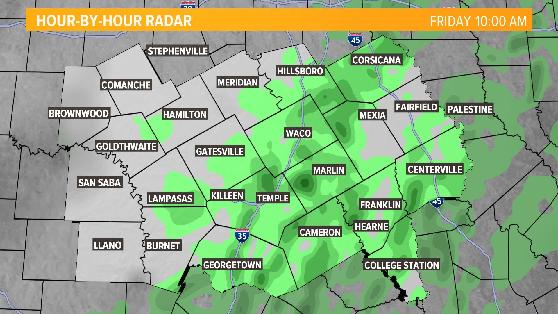
What time will the storms race across Central Texas?
As of 7:30 p.m., a strong to severe line of storms was crossing over the I-35 corridor from Hillsboro down to Waco and through Temple. The line of storms is expected to continue to slide off to the east through the evening hours. Storms are expected to be exiting the I-45 corridor around 10 p.m. to 11 p.m. Lingering scattered showers and non-severe thunderstorms will move east overnight.
How to share your pictures and videos
When you see weather outside your window share it with us. Only when it's safe and you're able to take pictures or videos send them to us by tagging us on social media and using the hashtag #BeOn6 or by emailing to news@kcentv.com. You could see it on 6 News and KCENTV.com.
What does an enhanced risk for severe weather mean?
Almost all of Central Texas is in a category 3 out of 5 for severe weather. Which is an enhanced risk, from the Storm Prediction Center, for severe weather Friday afternoon into the evening hours. This means our area has the potential for longer-lasting, strong to severe storms with the potential for several damaging elements. This includes the possibility of damaging winds more than 60 mph, damaging hail 1 to 2 inches in diameter, and a few tornadoes.
Northeast Texas has a higher risk of severe weather, as of the latest forecast. This means they have a better chance of widespread storms with strong tornadoes possible.
What does the weekend look like?
A windy and cooler air mass will move in behind the storm system as it exits stage right. Look for increasing sunshine Saturday, with highs only near 50 degrees and northerly winds 10 to 20 mph. We’ll see a mix of sun and clouds Sunday, with temperatures a little warmer near 61. Southerly winds return and will be a little breezy around 10 to 20 mph.
Our next rain chances return to Central Texas in the mid and latter part of next week.
Follow 6 News on social media
Twitter | kcennews/ https://twitter.com/6NewsCTX
Facebook | https://www.facebook.com/KCENNews/
Youtube | http://bit.ly/2Z6mT7N
STAY ALERT. STAY WEATHER AWARE: