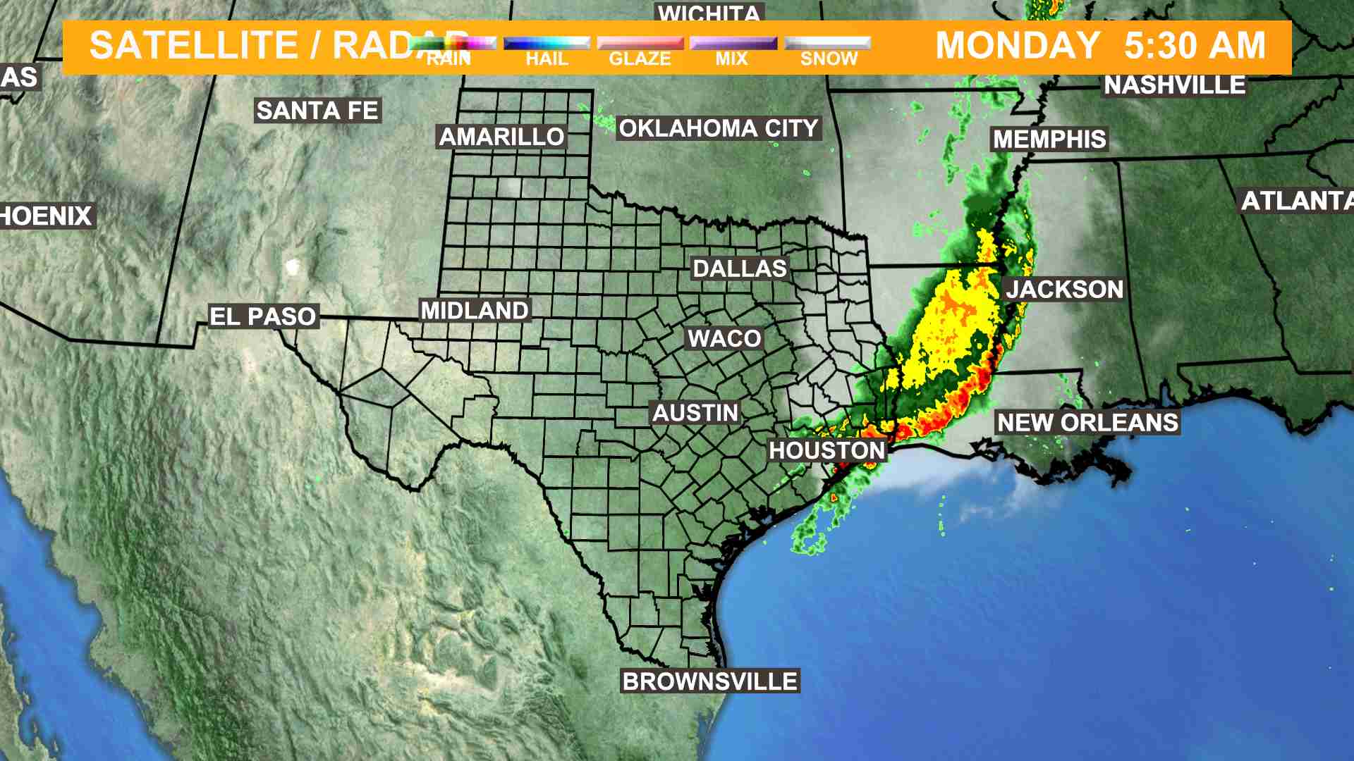
DHTML Javascript Menu By Milonic.com


Click Forecast Image to Enlarge

NBC 6 WebTrac
The most up-to-date weather in Central Texas!

What is WebTrac 6?
Video Webcast - Local & Regional Radars - Pollen Report
Current Conditions - Forecast - Severe Weather Alerts

Launch WebTrac

From the NBC 6
Weather Plus Weather Center


Some Rain Chances Return

We're going to see a couple more showers pop up across southern and western parts of Central Texas over the next couple days, but we will all see slightly better rain chances for the end of the week into the Labour Day weekend as a weak front stalls out near the Red River. Looking further down the line, a stronger front may move through the middle of next week, bringing slightly better rain chances to the forecast. In the meantime, all eyes are on Gustav, which is forecast to be a major hurricane in the Gulf by early next week.

FORECAST

Wednesday and Thursday: Mostly sunny and warm, with a shower possible in southern and western parts of Central Texas. Highs in the mid-90s.

Friday, Saturday, Sunday, and Labour Day: Partly cloudy with a slight chance of showers and thunderstorms. Highs in the lower-to-mid-90s.

Tuesday: Partly cloudy and warm. Highs in the mid-90s.

Have a great day!

Meteorologist Nick Piesco


Click here for a map of Texas counties with burn bans in effect

Click here for road conditions from TxDOT

Send us your weather photos!


More Weather Plus


Weather Plus Doppler Radar


Area Doppler Loop

Severe Weather Updates
 

© 2008 Copyright KCEN-TV Channel 6, Inc.
Copyright Notice *
Privacy Policy